Manaslu Circuit Trek at a Glance
- Highest Point: Larkya La Pass (5,106 meters and 16,752 feet)
- Distance on foot: About 140 km over 10 trekking days
- Standard length: 14 days from arrival in Kathmandu to departure
- Grade: Difficult, with no technical climbing required
- Walking Time: 5 to 8 hours, 8 to 10 hours on the Larkya La Pass day
- Best Season: Autumn (September to November) and Spring (March to May)
- Accommodation: Teahouse, mostly with twin-sharing beds and shared bathrooms
- Rules: All restricted area permits, a licensed guide, booking with a legally registered trekking agency, and travel insurance are all compulsory.
What is the Manaslu Circuit Trek?
The Manaslu Circuit Trek is an off-the-beaten-path trek in the northwest of Kathmandu. The trek mostly starts in Kathmandu and ends in Kathmandu. If you are not in Kathmandu or are staying in Pokhara while visiting and you want to join, it can be possible through a customized itinerary.
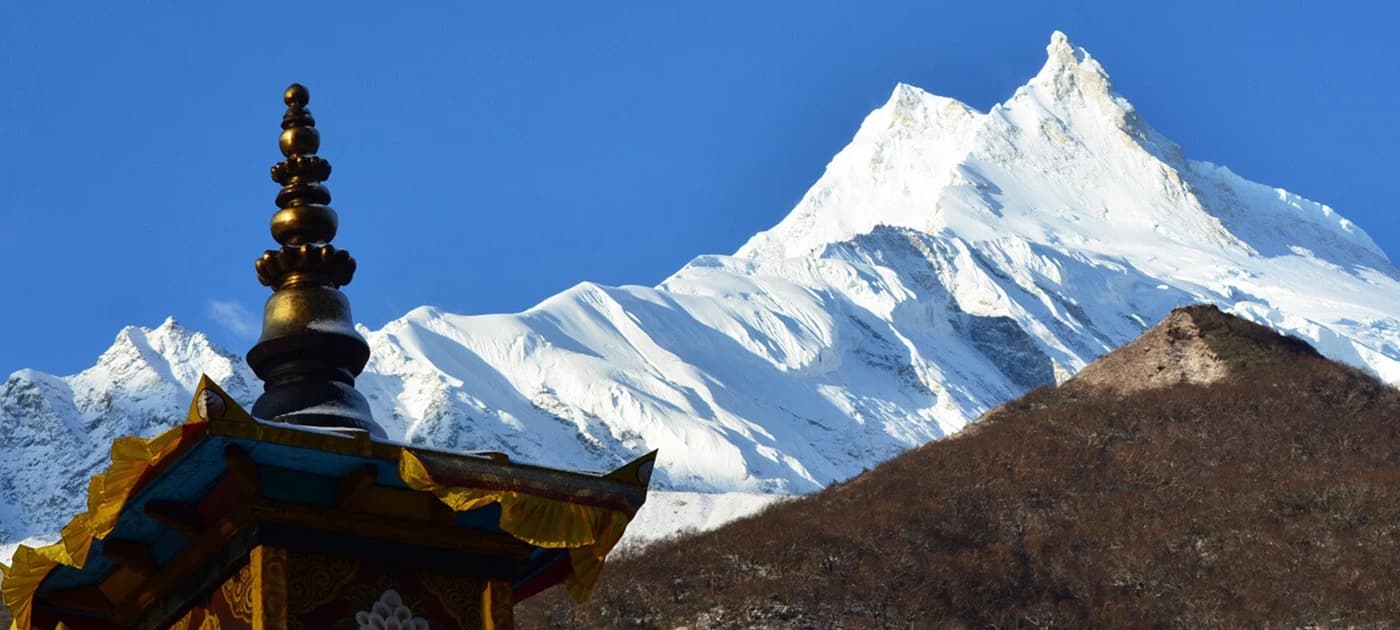
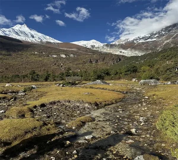
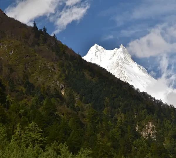
The full-circle trek of Manaslu offers unique and impressive views of the landscapes and mountains, including Manaslu (8,163 m/26,781 ft) and Annapurna II, a vast range of flora and fauna, glacier lakes, and monastery life.
Trekking the Manaslu Circuit is a lifetime experience. The Manaslu Circuit Trek is a less crowded trekking trail than the Everest Base Camp Trek, Langtang Valley Trek, and Annapurna Circuit Trek. You can enjoy the trek in peace and natural beauty away from the hustle and bustle.
Where is the Manaslu Circuit Trek?
The trek lies in the Gorkha district of north-central Nepal, around Mount Manaslu and the Budhi Gandaki Valley. Most of it falls inside the Manaslu Conservation Area and a government-designated restricted area in Tsuum Nubri Rural Municipality.
Mostly, it begins with a long and scenic drive from Kathmandu to Machha Khola. From there, the trail follows the Budhi Gandaki River north, climbs through the Nubri Valley to the high villages of Samagaon and Samdo, crosses Larkya La, and finishes in Dharapani.
Trekking Route to Manaslu Circuit
The Lower Valley: Machha Khola to Namrung
The first days follow the river through green forest, past waterfalls, and across suspension bridges. Jagat is the checkpoint for the conservation area. Near Khorla Besi there are natural hot springs, a good reward if you start your trek early. Deng is a Gurung and Tibetan village strung with prayer flags and mani walls, and Namrung opens up the first clear views of Ganesh Himal and Siringi Himal.
The Nubri Valley: Namrung to Samagaon
Above Namrung, the forest thins and the culture shifts. Lho and Shyala have the stone-built structures of houses, chortens, and gompas of Tibetan Buddhist life, and the views of Manaslu, Himalchuli, and Ngadi Chuli get closer by the hour. Many trekkers detour to Pungyen Gompa, set beneath the Manaslu Glacier, on the way to Samagaon, where the trail pauses for the rest day.
The High Country: Samdo to Dharamshala
Samdo is a small Tibetan-influenced settlement close to the border. The landscape is bare and rugged here, with yak pastures and mani walls. The trail passes Larke Bazaar and ends at Dharamshala, also called Larkya Phedi, which is at about 4,475 meters. It is known as the highest overnight stop and last bed before the pass.
Crossing Larkya La Pass
The pass day starts before dawn, usually between 3 and 4 in the morning, with headlamps on. You walk up over mesmerizing lakes and moraine slopes, then face a steep final ascent to the pass at 5,106 meters. On a clear day, the top gives astonishing views of Manaslu (8,163 m/26,781 ft.), Himlung Himal (7,126 m/23,379 ft.), Cheo Himal (6,820 m/22,375 ft.), Kang Guru (6,981 m/22,903 ft.), and Annapurna II (7,937 m/26,040 ft.). It is a cold, windy, snowy condition, and the long descent means trekkers normally spend only a short time at the pass before beginning the descent.
The descent is long. You drop about 1,516 meters to Bhimthang at 3,590 meters. The whole day takes from 8 to 10 hours.
The Descent: Bhimthang to Dharapani
The trail runs down through grassland and the Dudh Khola Valley, then into rhododendron (Laligurans in Nepali), oak, and pine forest. Tilije is the usual stop. From Tilije, the trail continues to Dharapani, where the Manaslu Circuit meets the Annapurna Circuit. A jeep takes you to Besisahar, and from there a bus runs to Kathmandu or Pokhara.
Roads keep creeping further up the valley, so exactly where the walking starts and ends can shift from year to year.
What Sets the Manaslu Circuit Apart?
Vivid Landscapes
Few treks change character as often as this one. You begin in subtropical forest with orchids and bamboo, then move through rhododendron and pine, and finally into alpine meadows and glacial terrains. The wildlife is just as varied. Endangered animals like Himalayan tahr, blue sheep, musk deer, snow leopards, and others live in the conservation area, but seeing any of them is never guaranteed; it depends entirely on your luck.
Nubri and Tibetan-Influenced Culture
The lower villages are a hub for Chhetri, Brahmin, and Magar communities. Higher up, the Nubri and Tsum people shape daily life, and Tibetan Buddhism is everywhere you look: prayer wheels, mani walls, and chortens and gompas such as Lho Gompa and Sama Gompa. Always walk clockwise around mani walls and chortens; keeping them on your right is the perfect practice.
Views of Manaslu and Its Neighbor
The glacial mountain grows as you walk north. Manaslu, Himal Chuli, and Ganesh Himal dominate the skyline, with the Annapurna range on the far side of the pass.
How Many Days Do You Need for the Manaslu Circuit?
Most Manaslu Circuit itineraries last 12 to 16 days. The length depends on where the walking starts, how many rest days are built in, and how much road you use at either end.
For a standard Manaslu itinerary schedule, it works like this:
A standard 14-day Manaslu Circuit Trek includes arrival in Kathmandu, transportation to the trailhead, around 10 days of trekking, an acclimatization day at Samagaon, the crossing of Larkya La Pass (5,106 m/16,752 ft), and transportation back to Kathmandu after reaching Dharapani. Here are the approximate distances and durations for the trek route:
- Day 1: Arrive in Kathmandu and transfer to hotel: 1,400 meters, about a 30-minute drive
- Day 2: Kathmandu to Machha Khola: 870 meters, 160 km by road, 8- to 9-hour drive, 530 meters elevation loss
- Day 3: Machha Khola to Jagat: 1,410 meters, 22 km, 6-to 7-hour trek, 540 meters elevation gain.
- Day 4: Jagat to Deng: 1,800 meters, 20 km, 7- to 8-hour trek, 390 meters elevation gain.
- Day 5: Deng to Namrung: 2,630 meters, 20 km, 7- to 8-hour trek, 830 meters elevation gain
- Day 6: Namrung to Shyala: 3,500 meters, 10 to 13 km, 5- to 7-hour trek, 870 meters elevation gain
- Day 7: Shyala to Samagaon: 3,530 meters, 9 to 12 km, 4- to 5- hour trek, 30 meters elevation gain
- Day 8: Acclimatization day at Samagaon: 3,530 meters, rest for the day or optional hike of 1 to 8 hours
- Day 9: Samagaon to Samdo: 3,875 meters, 8 km, 3- to 4- hour trek, 345 meters elevation gain
- Day 10: Samdo to Dharamshala: 4,475 meters, 7 km, 3- to 4- hour trek, 600 meters elevation gain
- Day 11: Dharamshala to Bhimthang via Larkya La Pass (5,106 m): 3,590 meters, 14 to 15 km, 8- to 10- hour trek, 631 meters elevation gain to pass and then 1,516 meters elevation loss
- Day 12: Bhimthang to Tilije: 2,300 meters, 19 to 20 km, 5 to 6 hour trek, 1,290 meters elevation loss
- Day 13: Tilije to Dharapani, then drive back to Kathmandu: 1,400 meters, 7 km trek, then 220 to 225 km by road, 2 to 3 hour trek, then 8 to 9 hours drive, 340 meters elevation loss to Dharapani (1,960 m), then 560 meters elevation loss
- Day 14: Final Departure: Airport transfer through private vehicle
You can shorten the trek with the Short Manaslu Trek package, but fewer days mean longer walking days and less room for bad weather or a slow day. If you have more time, you can add side trips as well. The Tsum Valley extension is the best known. A day hike from Samdo toward the Tibet border and a visit to Serang Gompa are shorter options.
For the complete route, daily itinerary, inclusions, and current budget, see Manaslu Circuit Trek-14 Days Here!
Price from
US$893
Off-The-Beaten-Path Route
How Hard Is Manaslu Circuit Trek?
The trek is rated difficult but not technical because of its demanding terrain, rough ground, long days, and high altitude. One of the most difficult aspects is crossing the Larkya La Pass, which stands at 5,106 meters (16,752 feet). You do not need ropes or climbing skills.
Terrain and Daily Walking
Expect the trek to involve steep ascents and descents, with some trails being narrow and rugged, featuring cliffside paths, stone steps, and glacial paths. Most days involve 5 to 8 hours of walking. Near the pass, cold, snow, and ice can add to the effort, depending on the season.
The high altitude poses a risk of altitude sickness, making acclimatization crucial. Additionally, the remote location of the Manaslu region means fewer facilities and support services along the way, adding to the difficulty.
Fitness and Experience
The requirement is good physical fitness and stamina. You should be comfortable walking uphill for hours on consecutive days. Regular walking, cardio, jogging, and leg strength work in the weeks before you travel make a real difference.
Previous high-altitude trekking helps, though many fit first-timers complete the route with good preparation.
Acclimatizing on the Circuit
The route rises above 3,000 meters by the middle of the trek and stays high until the descent from Larkya La. That is why a rest day matters.
How the Route Builds In Acclimatization
The usual rest is at Samagaon, at about 3,530 meters. You can rest in the village or take an optional walk to higher areas and sleep back down. An optional hike like Birendra Lake is a gentle hike of about a one- or two-hour walk. The Manaslu Base Camp hike is longer, around 6 to 8 hours round trip, reaching about 4,800 meters, and only suits people who feel strong.
Recognizing Altitude Sickness
Altitude sickness can affect anyone, whatever their age or fitness. Watch out for signs like headache, nausea, dizziness, tiredness, poor sleep, and loss of appetite. Drink enough fluid a day, do not avoid regular meals even when appetite drops, and it is best to avoid alcohol.
What to Do If Symptoms Get Worse
Early signs are not supposed to be ignored; tell your guide immediately. Symptoms that worsen, or appear while you rest, should never be pushed through. Your licensed guide will always help you decide when to rest and when to descend.
Manaslu Permit at a Glance:
Restricted Area Permit (RAP):
It is necessary for all trekkers.
- Permit Fare for Foreigners: USD 100 per person for the first 7 days from Sep-Nov, plus USD 15 for each extra day. From Dec-Aug, the fee is USD 75 for the first 7 days, then USD 10 for each extra day.
Conservation Area and Local Permits:
Manaslu and Annapurna Conservation Area Permits (MCAP and ACAP) are also needed for all trekkers. Issued by the MCAP and ACAP offices or authorized agencies.
For MCAP:
- Permit fare for foreigners: NPR 3,000 (approx. USD 30)
- For SAARC nationals: NPR 1,000 (approx. USD 10)
- For Nepali nationals: NPR 100
- Children (below 10 years): Free
For ACAP:
- Foreigners: NPR 3,000 per person
- SAARC Nationals: NPR 1,000 per person
- Nepali: NPR 100 per person
- Children: Free for those below 10 years old
Tsum Nubri Rural Municipality local fee:
- NPR 1,000 per person, where applicable.
TIMS:
The Manaslu Restricted Area Permit must be arranged through a registered trekking agency. You normally provide your passport copy and trekking details to the agency, which handles the permit application and other required documentation. The Department of Immigration currently lists same-day processing for Manaslu trekking permits when a complete application is submitted before 1 PM.
The permit fees and trekking regulations can change, so it’s best to confirm the current requirements with reliable sources.
Going Solo: The 2026 Rule Change in Brief
Until 22 March 2026, a restricted area permit required at least two foreign trekkers on the application. Nepal’s Department of Immigration has removed that rule, so one traveler can now apply alone.
The guide requirement has not changed. You still cannot trek Manaslu independently. The trek must be booked through a registered agency, and a licensed guide must walk with you. Under the revised rules, one guide can lead up to seven trekkers.
Best Time for the Manaslu Circuit
The ideal seasons to trek the Manaslu Circuit are spring and autumn, though hikers can attempt it year-round. Ideally, during these periods, the climatic conditions are rather cool and dry, perfect for sightseeing the surrounding topography. The temperatures are moderate, making them appropriate for trekking during the day while at the same time being calm for camping at night.
Spring (March to May):
The climate in the Manaslu area is quite good in spring because of its moderate temperatures and clear blue sky. It is warm, with temperatures ranging from 10 to 20 degrees Celsius in the lower parts during the daytime.
The rhododendron flowers bloom along the trail, and the forests look gorgeous. During this season, flowers bloom, and the weather is comparatively dry and stable for trekking on the trails.
Some parts may be cool in the morning and at night, but with a few showers, it is one of the best times for trekking. The countryside blossoms with rhododendrons, making the valleys and hills as green as an emerald, with splashes of color here and there.
Summer/Monsoon (June to August):
During the summer or monsoon season in the Manaslu region, there is heavy precipitation, which makes trekking difficult and sometimes risky. Some of the paths get flooded; some turn into swamps; the terrain becomes slippery; and there are possibilities of landslides, especially when the paths are through steep slopes.
It can still be warm during the day, with average temperatures between 15 and 25 degrees Celsius near sea level; however, it rains constantly, the skies are overcast, and it is impossible to see the mountains. It is advisable not to trek during this season due to the harsh climatic conditions and increased cases of instability.
Autumn (September to November):
However, many consider autumn to be the best time to hike the Manaslu Circuit. The weather during this season is characterized by cool, dry, and clear conditions during the mornings and warm and sunny conditions during the afternoons.
Autumn does not have problems such as muddy roads and hazy skies, so this is the best time for taking pictures of the mountain.
The temperatures range from 10 to 20 degrees Celsius during the day, especially in low-altitude regions, which are good for trekking. The weather is fairly decent, with few clouds providing a stunning vista of the snowy mountains and the surrounding terrain.
This season also comes along with festivals within the area, which makes the trekking experience even more colorful.
Winter (December to February):
The winter season consists of cold temperatures with occasional snow at the higher elevations in and around the Manaslu area. The lowland region experiences daytime temperatures of 5 degrees Celsius up to 15 degrees Celsius, while nights are considerably colder or freezing, particularly from December to February
Snow can hinder trekking, especially when crossing hills, mountains, or any region with high altitudes. However, the trails are less crowded, and the sky is blue, which makes for a very different and beautiful trekking experience if the cold does not bother you.
It is thus advisable to take on the Manaslu Circuit Trek during the spring and autumn seasons when the weather is more favorable for trekking.
Teahouse Accommodation on the Trail
Lodging facilities are available all along the trek, specifically in the form of teahouses or guesthouses, which are simple lodging establishments that provide numerous services to the trekkers. These teahouses are set up in villages along the trekking path and offer food and beverages and a place to meet and lodge with other trekkers.
The teahouses commonly provide spare, small rooms, most of which have twin beds or bunk beds, spare bedding, and WC/bath-sharing facilities. Teahouses may also have private rooms with bathroom facilities; however, they are limited in number, and the price may be a little steep.
A public field within the teahouses comprises a dining area where trekkers may take their meals, a lounge, and, at times, a small store that deals in food items, drinks, and trekking requirements.
In some trekking trails, there might be several standard amenities in the accommodation, but as one gets to the more interior villages, the comfort might be quite humble. It’s recommended to bring a sleeping bag because the bedding may be inadequate in the teahouses, particularly at high altitudes.
Manaslu Circuit Trek Toilet Facilities
Bathroom Standards by Altitude:
- Lower Altitude Area (Machha Khola to Jagat): You will find a mix of simple Western-style and traditional squat toilets. A small number of teahouses offer rooms with private attached bathrooms.
- High Altitude Area (Namrung, Samagaon, Samdo, Dharamshala): Shared hallways or outdoor squat toilets become the standard. Attached private bathrooms are rare to non-existent here.
- Flush System: Most higher-altitude facilities rely on a bucket-flush system (manually pouring water into the pan), and pipes can freeze during cold mornings or overnight.
Other facilities get more basic as you gain height. Hot showers usually range from USD 2 to USD 5. A warm sleeping bag is useful even where bedding is provided, and some agencies lend one.
Internet, Wi-Fi, Electricity, and Mobile Signal
Wi-Fi and Internet Access
Along the trek, access to Wi-Fi, electricity, and charging facilities is limited and varies by location. In lower-altitude villages, some teahouses offer Wi-Fi and mobile service for a small fee of about USD 2 to USD 3, but the connection gets patchy and can be slow and unreliable. As you ascend higher, Wi-Fi becomes scarcer.
Mobile Network and Signal
Nepal Telecom generally has better coverage than Ncell around Samagaon and Samdo. Most of the teahouses let you charge your devices for the amount around USD 2 to USD 4 for a full charge. It's advisable to carry a high-capacity 10,000 to 20,000 mAh portable power bank to ensure your devices stay charged throughout the trek when electricity is more reliable.
Electricity and Charging Facilities
Electricity is generally available in most teahouse areas, but supply becomes more limited, solar-dependent, and expensive as you go to the upper parts of Manaslu. In the lower and middle sections of the trail, electricity is generally reliable, while charging becomes less dependable at higher elevations.
In the lower and middle elevations, from Machha Khola to Namrung, teahouses generally have reliable electricity powered by local micro-hydro power or a grid system. You can find electrical sockets in rooms or communal dining spaces, which makes it easier to charge your phone, camera, headlamp, and other devices.
As you reach higher elevations such as Samagaon, Samdo, and Dharamshala, electricity becomes more limited. Lodges rely heavily on smaller solar-based systems, so power can be intermittent and dependent on weather conditions. Charging facilities are most often available in the shared spaces, particularly in the dining hall, rather than inside individual rooms.
When crossing Larkya La Pass, you should not expect dependable electricity or charging options. Usually, there are very few chances of charging services while crossing the high pass, and electricity can also be very limited around Dharamshala.
Manage Electricity During the Trek
A compact universal adapter with multiple USB ports is very useful for charging multiple devices, while keeping your phone and spare batteries close to your body in cold weather can help prevent lithium-ion batteries from draining quickly.
Food and Drinking Water on the Trail
Meals:
The food is quite diverse on the trek, with a mix of Nepali, Tibetan, Chinese, and continental, so you can find a variety of options along the route. Teahouses and lodges of Manaslu serve everyday meals and beverages such as tea, coffee, hot chocolate, and snacks en route, and food choices can be scarce depending on the altitude and distance from civilization.
A few local dishes are especially common on the trail. Typical Nepali meals include Dal Bhat, which is rice and lentil soup accompanied by vegetables and sometimes meat; it is a popular and filling choice for you. You can find momos, which are steamed dumplings filled with meat or vegetables, and thukpa, a warm noodle soup that is particularly comforting in colder weather.
As for the choice of meals, almost every teahouse offers some Western food like pasta, pizza, pancakes, porridge, and others, but the quality and variety may not be as great as you would find in restaurants in larger cities. But these meals still provide convenient options during the trek.
Food hygiene is important, especially at higher altitudes where your body is already under stress. Choose freshly cooked hot meals and avoid raw dishes, salads, or cross-contaminated food to prevent instances of foodborne illness.
Drinking Water:
Drinking water is available at teahouses and along the trail, but trekkers should take care to drink treated or purified water. You can carry a reusable water bottle and refill it with boiled, filtered, or properly treated water, while water purification tablets or a portable filtration system can be useful when needed.
Staying well hydrated is especially important at higher elevations, where dehydration can make trekking more difficult and may worsen altitude-related discomfort. Carrying your own reusable bottle and regularly refilling it is a practical way to stay hydrated throughout the trek.
Suggested Trekking Gear
Having the right trekking gear is important for a comfortable and successful journey on any trek. Your clothing and equipment may vary depending on your personal body type, how your body responds to the cold, and the season of your trek. The following checklist covers the essential gear you may need for the journey.
Head and Sun Protection
- Trekking hat or cap
- Good-quality headlamp or flashlight with extra batteries
- UV-protection sunglasses
- Woolen hat or beanie for cold weather
- Bandana or buff for sun and dust protection
- Sunscreen with SPF 40 or higher
- Insect repellent
Upper Body
- Two base-layer shirts made from moisture-wicking and breathable fabric
- Lightweight trekking jacket that is water-resistant and windproof
- Insulating layer such as a fleece, down jacket, or warm sweater
- Lightweight waterproof rain jacket or poncho
- One long-sleeve shirt for sun and insect protection
- Two pairs of moisture-wicking, quick-drying underwear
- Compression garments, if needed, to help reduce muscle fatigue
- Gore-Tex or similar waterproof jacket
Lower Body
- Two pairs of trekking pants, including convertible options if preferred
- One pair of thermal leggings for cold weather
- Two pairs of shorts, optional for warmer conditions
- Knee guards or knee support for those who need additional protection
Handwear
- Lightweight inner gloves for lower elevations
- Insulated or down gloves for higher-altitude trekking
- Waterproof gloves for wet conditions
- Warm gloves for protecting your hands from cold temperatures
Footwear
- Comfortable, waterproof trekking boots or shoes with good grip and ankle support
- Gaiters to help keep mud, snow, and rocks out of your boots
- Two pairs of thick, moisture-wicking socks made from merino wool or synthetic materials
- Two pairs of lightweight socks for warmer conditions or layering
- Sandals or flip-flops for use at teahouses and during rest periods
For Toilet and Hygiene Items
- Toilet paper or tissues
- Hand sanitizer
- Biodegradable soap
- Wet wipes
- Small quick-drying towel
- Toiletries such as toothbrush, toothpaste, and shampoo
- Personal toiletries
- Small waterproof toiletry bag
- Plastic or reusable bags for carrying used tissues or personal waste when necessary
Extra Suggested Things
- Sleeping bag
- Trekking poles
- Extra Nepali cash for personal and additional expenses
- 60L or larger backpack or rucksack with a rain cover
- Hydration system, water bottles, or CamelBak
- Water purification tablets or a portable filter
- Energy snacks such as bars, dried fruits, and nuts
- Basic first-aid kit with items such as bandages and antiseptic, according to personal needs
- Trekking map or GPS device
- Portable power bank for charging electronic devices
- Camera or smartphone for capturing the mountain views
- Emergency whistle
- Dry bags for protecting clothes and valuables
- Extra clothing layers
- Duct tape
- Fire-starting items such as matches or a lighter
- Notebook or journal for documenting your trekking experience
Travel Insurance for Manaslu
Travel insurance is compulsory for this trek. Your policy should cover high-altitude trekking, and coverage to at least 6,000 meters is recommended. It must also include emergency helicopter evacuation, which can be between USD 3,000 and USD 5,000 and is paid for by your insurer. Check the maximum altitude, evacuation cover, and emergency contact process.
Transportation to and from the Trail
Kathmandu to Machha Khola
The drive covers about 160 kilometers and takes 8 to 9 hours, mostly on the Prithvi Highway followed by an off-road stretch after Salyantar. You can go by local bus, shared jeep, or private jeep. Bring motion sickness tablets if you are prone to car sickness.
Dharapani Back to Kathmandu
From Dharapani, the road runs to Besisahar, then on to Kathmandu or Pokhara. The whole drive is about 220 to 225 kilometers and takes 8 to 9 hours.
Heavy rain, landslides, and construction can change road conditions, so leave a buffer day if you have a flight to catch. For this year's conditions, read our Nepal trekking safety guide.
What Should You Budget for Manaslu?
Guided package: The price depends on group size, season, and the package’s inclusions. You should always check whether permits, meals, transport, and accommodation are covered in the package. Generally, approximate prices range from USD 750 to USD 2,200.
Porter: Porter facilities are optional but easy if you can hire one. A porter can carry up to 20 kilograms and share it between two trekkers. Usually they charge around USD 240 per trek, which is on a shared basis with two trekkers.
Cash on the trail: Carry NPR 2,500 to 3,000 per day for drinks, snacks, charging, hot showers, and small extras. There are no ATMs beyond Kathmandu, and credit cards are not accepted on the trail.
Tips for guides and porters: It is better to plan for a set amount for appreciation after trek completion.
Usually not included: International flights, Nepal visa, travel insurance, personal gear, drinks, and laundry.
For a full breakdown, read this Manaslu Circuit Trekking Cost guide.
Optional Side Trips on the Trek:
Price from
US$703
US$1050
Off-The-Beaten- Path Track
The trek already offers plenty to see, but you can add a few short hikes or detours if you have enough time and energy. Most of the useful side trips are around Samagaon and Samdo, where an additional walk can also support acclimatization before the Larkya La Pass.
Side trips are optional and should depend on your fitness, weather, available time, and how you are feeling at altitude. Your guide can help you choose the most suitable option.
- Pungyen Gompa (around 4,050 m/13,287 ft.): Pungyen Gompa is a Tibetan Buddhist monastery in the upper Manaslu region, with impressive views toward Manaslu and the surrounding glacial landscape. It can be visited around the Shyala to Samagaon section or as a separate hike from Samagaon, depending on the itinerary and trail conditions. Unlike Birendra Lake, this is not simply a quick walk beside the main trail. The detour involves additional climbing and walking, so allow enough time if you plan to include it.


-
Birendra Tal (3,450 m/11,316 ft): Birendra Lake is one of the easiest side trips from Samagaon. The glacial lake sits below the Manaslu Glacier and can be visited during the acclimatization day. It is a good option if you want a shorter walk without committing to the more demanding hike toward Manaslu Base Camp.
The walk provides views of the surrounding glaciers and mountains before returning to Samagaon for the night. Birendra Lake can also be visited on the route toward Manaslu Base Camp.

- Manaslu Base Camp (4,800 m/15,748 ft.): The base for the Manaslu expedition pitches their tent and stay for acclimatization. It is a 6-8-hour walk from Samagaon onto the steep slope. The hike to Manaslu Base Camp is a much more demanding option than the one to Samagaon. The trail climbs significantly higher through glacial and moraine terrain, reaching approximately 4,800 m. It is commonly used as a challenging acclimatization hike because you climb high and return to sleep at Samagaon. The hike can take most of the day, so it is better suited to trekkers who are acclimatizing well and have enough energy for the return journey.
- Samdo and the Tibet Border Viewpoint: After reaching Samdo, trekkers with additional time can take a higher-altitude day hike toward the Nepal-Tibet border area or nearby viewpoints. This is considerably more remote and demanding than the shorter walks around Samagaon. Because of the altitude, weather, terrain, and proximity to the international border, this should only be attempted with your guide and when conditions are suitable. It is best treated as an additional excursion rather than part of the standard trekking route.
- Serang Gompa (3,100 m/10,170 ft): Known as Nubri Gumba, it lies in Tsum above the Bhī village. It is a meditation monastery bordering Tibet, and a refuge has existed on this high-altitude southern slope for more than 500 years.
- Kal Tal (3,600 m./11,808 ft.): The detour to Kal Tal is 4 hours of walking above the Prok village. This lake is also known as Kulmachum Lake. This is a scenic spot to view the diverse landscape.
- Hinang Gompa and Himalchuli Base Camp (4,020 m, 13,186 ft.): It is a beautiful monastery from Bhi. Walk for about an hour and reach the monastery in the meadows of a pine forest.
- Tsum Valley Extension: Tsum Valley is not a simple side trip from the main Manaslu Circuit. It is a separate multi-day trip around 1 or 2 more extra days of extension into the Tsum Valley, and requires additional time, permits, and planning. If you want to combine Tsum Valley with the Manaslu Circuit, plan the extension before starting the trek rather than treating it as a spontaneous day hike along the standard route.
Common Questions About the Manaslu Circuit
Is a guide compulsory?
Yes, a licensed guide must accompany every trekker in the restricted area, including solo travellers.
How far do you walk each day?
Most days are 5 to 8 hours. The Larkya La day takes 8 to 10 hours.
Where does the Manaslu Circuit start and end?
The walking usually starts at Machha Khola and finishes at Dharapani. The road sections on either side connect to Kathmandu.
Can you combine Manaslu with Tsum Valley?
Yes, Tsum Valley is an optional extension that adds extra days and needs its own permit and local fee.
Is the Manaslu Circuit suitable for first-time trekkers?
It can be if you are fit and well prepared. The trek is difficult but non-technical, so previous experience helps rather than being essential.
Can I trek in winter?
Yes, you can trek in winter, but good preparation for trekking in the cold season and previous trekking experience can be very helpful.
Book the Manaslu Circuit Trek With Global Adventure Trekking
If you are planning a Manaslu Circuit Trek, Global Adventure Trekking (GAT) can arrange the permits, licensed guide, accommodation, transportation, and trekking logistics from Kathmandu or Pokhara.
Our classic 14-day Manaslu Circuit Trek follows the route from Machha Khola and Dharapani and includes an acclimatization day at Samagaon. It is a great achievement to cross the Larkya Pass (5,106 m).
You can join us solo or in a group. We are here for your safe and successful trekking journey and a lifetime of happy memories.